Marked Trails In & Around Smedley Park
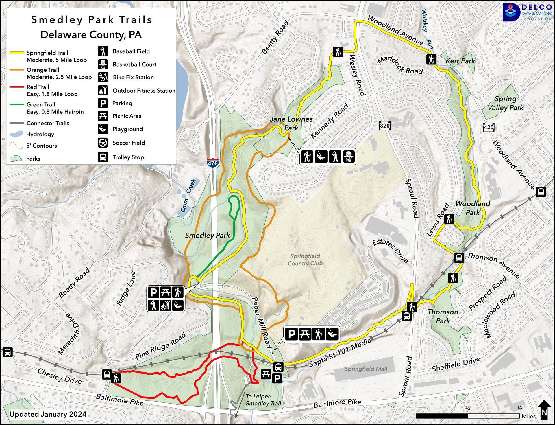
There are now four marked trails, totaling almost 10 miles, in & around the park. In addition, there are a number of other unmarked trails. Three of the trails intersect at the “Hub” next to the third footbridge over Crum Creek.
- YELLOW (Springfield Trail) is a 5.0 mile loop that connects Smedley Park with three Springfield Township parks (Jane Lownes, Woodland & Thomson), as well as other privately owned wooded areas. About 90% of it traverses wooded areas and about 10% is on neighborhood sidewalks. It is hilly in many places, with a total of about 400 ft. of elevation gain. There are about a half dozen water crossings. It can be accessed at any of 13 trailheads each indicated by large, informative signs with maps.
- ORANGE is a 2.5 mile loop that essentially circles much of Smedley and Jane Lownes Parks, including a high trail around the perimeter of the golf course. It has 200 ft. of elevation gain and two water crossings. It runs concurrently with the Yellow (Springfield) Trail on part of the carriage trail in Smedley and from the Jane Lownes Trailhead to the Quarry Cliffs Trailhead.
- RED is a 1.8 mile loop that runs along Pine Ridge Run (and the trolley tracks) toward Media and along Baltimore Pike. It passes next to the Penn State Extension office and the Environmental Center. While it is somewhat hilly, the elevation gain is not too great. There are no water crossings.
- GREEN is a 0.8 mile hairpin shaped trail that starts beyond the back parking lot next to the baseball field. It is relatively flat and has no water crossings.